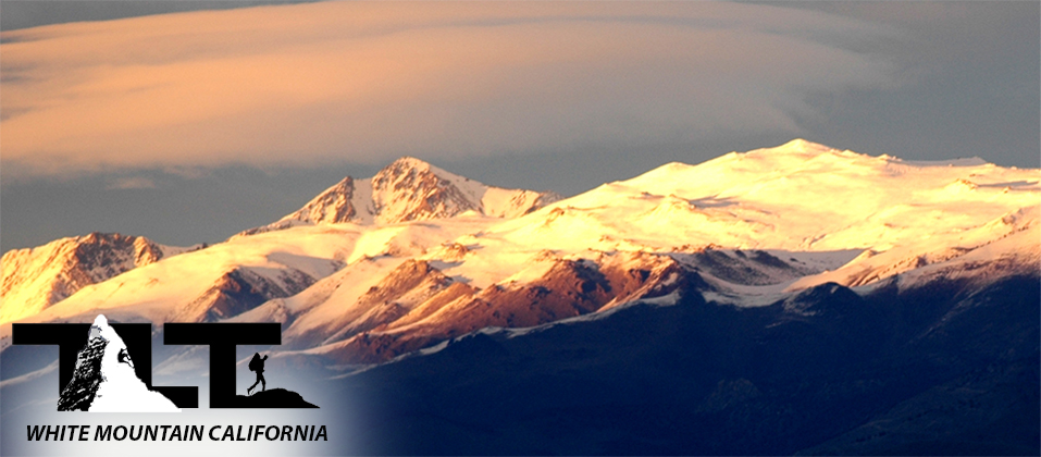
 White Mountain Peak located in the US state of California is not well known by the majority of people in the state and around the world, but this does not take away from the fact that this Lonely alpine range has much to offer. Overshadowed by the rugged Sierra Nevada on the western side of the region, visitors traveling along highway 395 are usually unaware that White Mountain looms high above to the east.
At 14,246 feet above sea level, White Mountain positions itself as the third highest peak in the state. With both the White Mountain and Sierra Nevada Range towering above 14,000 feet, the 10,000 plus foot vertical drop into the plains below make Owens Valley one of the deepest valleys in North America. The White Mountains are also one of the driest mountain ranges in the world for its height. This is due to the fact that the great barrier of the Sierra Nevada blocks moisture coming in from the west.
The White Mountains begin in Nevada at Montgomery Pass on U.S. 6, and head south for a distance of 60 miles, where at that point the Inyo Mountains take over. Westgard Pass and Deep Springs Valley separate the White Mountains from the Inyo Mountains. The range reaches its greatest width of 22 miles just east of the town of Bishop, California.
 Most of the moisture (about 12 inches annually) comes in the form of snowfall during the winter months. As Pacific storms move eastward along the Sierra Nevada, high altitude conditions rob the majority of moisture from the air, and leave only strong dry winds swirling about the slopes of White Mountain.
On a typical summer day the amount of precipitable moisture in the air is about one half of a millimeter. This is the lowest moisture level that has ever been recorded on planet earth.
Dry air is not the only notable distinction of this desert like mountain. High winds are also a White Mountain trademark. To add proof to this fact, the summit climate station recorded a 162.4 mile per hour wind speed on December 19, 2008 at 5 AM. A wind speed like that would definetely knock you off your feet.
 Summit hikers and climbers on White Mountain will be traveling mostly in the alpine zone and temperatures there will range anywhere from 65 to 37 degrees F in the summer and 36 to -26 degrees F in the winter months. All this wind, dry air, and often times extreme cold makes White Mountains a very inhospitable environment for all life forms.
To add to the problems listed above, the soil quality is also poor, and at its worst in the alpine zone. This factor combined with a limited growing season, results in very sparse and delicate plant and wildlife. Because of this, visitors are cautioned to be careful not to disturb these very fragile life forms.
The sub-alpine forests of the Great Basin support the Bristlecone Pine (shown in the photo to the right), (shown in the photo above), and the permeable dolomite and certain granite substrates also support the Limber pine. Further below, denser stands of Piñon pine and Utah juniper abound. These upper and lower conifer zones are often separated by a zone of mountain-mahogany brush. Various subspecies of sagebrush extend from the surrounding valleys to the lower alpine zone.
Most hikers on White Mountain wanting to reach the summit spend most of their time above 11,500 feet. At this level, the main vegetation disappears and rocky barren soil replaces it.
This high altitude terrain is quite destitute compared to the Pinion Pine and Bristlecone Pine trees that line the slopes from about 7,000 to 11,000 feet. Below the 7,000 foot level there are few trees present and the vegetation there gives way to mostly sagebrush and other desert like plant life. If you decide to take a trip to the White Mountains and hike to the top, you will travel through several climate zones. A treker could start off in the desert, and end up in the snow covered slopes of the high alpine zone in a single 24 hour period or less.
 All the above being said, White Mountain is certainly not without a beauty all its own. The clean, dry, crystal clear air, combined with the low angle shadows of the early morning and late afternoon sun make for stunning opportunities for landscape photography. But as always, no photo can ever do justice to the beauty that the human eye is capable of capturing.
In the photo to the left above you can see the summit of White Mountain looming high above in the upper far left hand portion of the image. It is surrounded by the surreal scene of the light green grassy slopes in the foreground. All this comes together to create a beauty that can only be experienced in the high desert peaks of California.
Also note the dirt road located in the lower right hand portion of the image. This is part of the unpaved section of the approach road that leads to the traditional starting point for summit hikers on White Mountain Peak.
 In the photo to the left above you a get a good idea of the landscape along the White Mountain trail/road. The road is closed to all but bicycle and foot traffic nearly all year. Only those who are a part of the Barcroft Research Station are allowed to drive motorized vehicles along this road.
The terrain is very barren and during most of the year there is no water to be had, so make sure you carry plenty of water for your drinking needs. High altitude makes for a very dry atmosphere, and dehydration can become a very serious situation if you run out of water.
 The path from the locked gate to the summit and back is a little over 14 miles, and skirts along some of the most barren terrain in all of California.
In the photo to the right, above, you see a hiker at about the half-way point with White Mountain Peak in the background. As you can see, you still have a fair amount of altitude to gain before reaching the top. Very little grows up here, and timberline ends far below.
These slopes (due to the fact that there is nothing in the way to block it) can be subject to high winds which can add considerable to the chill factor during cold periods of the year.
 In the image to the left, above, note the lone hiker nearing the summit, as he traverses one of the steeper sections of the trail.
There is still a fair amount of snow present at the 14,000 foot level in the month of June. The US state of Nevada appears far below in the distant horizon.
In the image to the left, above, note the lone hiker nearing the summit, as he traverses one of the steeper sections of the trail.
There is still a fair amount of snow present at the 14,000 foot level in the month of June. The US state of Nevada appears far below in the distant horizon.
It will not be long before you are on the summit, and there you will get a 360 degree view of the Sierra Nevada and the landscape of the state of Nevada as mentioned above. Also you will get a first hand look at the weather and high altitude research station that are located on summit of White Mountain.
 Hiking to the top of White Mountain Peak is a great way to get introduced to high altitude mountain travel. It will certainly give you a good idea of how you will perform when hiking and climbing in the thin dry air that is typical when it comes to alpine ascents.
What makes White Mountain such a great starting point for up and coming mountaineers, is that one travels by motorized vehicle to a very high starting point (11,670 feet), which then gives you access to a nice broad hiking path that leads to the peak's very respectable 14,246 foot summit. At this altitude, oxygen and the pressure level is about 1/3 less than that at sea level.
Most hikers that attempt White Mountain live at low altitudes and getting used to the low pressures and thin air can be a problem.
Headaches, nausea, and other such symptoms of Altitude Sickness can certainly spoil your outing. If this is a problem for you, then it would be wise to slowly get acclimated at a lesser elevation before tackling White Mountain Peak.
 In the photo to the left above you will see the last public restroom before starting up the trail to the top of White Mountain. It is a chemical type facility, and is usually well stocked with toilet paper for those last minute necessities.
Please do not throw trash or other foreign objects in the toilet. It makes for a very nasty job to remove it latter on. Bears and other wild life are not a problem on White Mountain, so keep any trash in your vehicle and deposit it later in the appropriate place once down off the mountain. Doing this will assure that this amenity will be there for others to use in the future.
 In the right hand In the above image (if you look carefully), you see the trail switch backing up the final slopes of White Mountain Peak. This is the most difficult part of the climb, and in this section you will gain the most elevation for the amount of distance traveled. Just before getting to the final summit approach, you will drop down approximately two hundred feet before you begin ascending once more. This is always a bit discouraging, because it's never fun to loose your hard earned elevation gain only to have to make it back up later on. But all this is just part of the story when it comes to treking through the hills in most areas.
 Above, you can see the Summit of White Mountain in the background. Note the beautiful variation of colored minerals that are lit up by the mid afternoon sun.
Most photos of White Mountain Peak will be best taken in the late afternoon. Also note the rock in the foreground. Quartzitic, sandstone, and granite bedrock along with extensive outcrops of dolomite (limestone) make up the geological formations of the range.
Well, that's about it for the introduction to the White Mountains. Hope that you enjoyed learning a bit about White Mountain. Please check out the menu at the top and click on the White Mountain option for more info on this wonderful California 14er.
Deeper Insight - Trials and Adversity in Life
On the surface, logic would seem to dictate that the White Mountains would be the last place on earth you would go to find the oldest living things. You would think that extreme dryness, poor soil, ferocious winds, bitter cold, and high altitude would shorten
the life span of any living organism. But harsh conditions and adversity are just what the doctor ordered when it comes to long life
for the Bristlecone Pine. With some trees reaching an age of 4,500 years or more, the Bristecone Pine is certainly tenacious of life.
But what about adversity when it comes to the human condition? We all try to avoid trials and troubles, but it seems as though they
are unavoidable in this life. If you have not put much thought or study into this matter, you may be surprised to learn that trials and
troubles are there by design.
In Job, one of the oldest books of the Bible, God tells us that "Hardship does not spring from the soil, nor does trouble sprout from the ground. Yet man is born to trouble as surely as sparks fly upward." (Job 5:6-7) Jesus later tells us in John 16:33b "that in this world you will have trouble"
We need to realize that afflictions do not rise out of blind chance but are sent and managed by a wise and merciful God. Sufferings remind us of God's providence and of our dependence on Him. They expose our weaknesses and teach us of how limited we are to supply our deepest wants in life. We learn that we are powerless to remove afflictions and sufferings, and they will remain until God in His infinite wisdom has decided that they have served their purpose. We know that God has the power to grant our wishes, but most often, His wisdom sees fit to withhold or even take away. This enables us to concentrate more on Him as the Giver than on His gifts.
If you have spent any time at all exploring or photographing the great outdoors, there is no doubt that you have discovered that the most spectacular sunrises and sunsets occur just before, during, or after a storm. Light mixed with storm clouds will often work together to produce indescribable beauty. Charles Spurgeon puts it this way: "A man who should live and die without trials would be like a setting sun without clouds; he would have little opportunity for the display of those virtues that the grace of God has endowed him with." You see, it is the storms in life that bring out one's true character, whether good or bad.
One day, all the above will come into sharp focus, and we just may find that our current day misfortunes have actually been the source of our greatest blessings.
So in the strength of the Lord, may we all continue to persevere,
Dave French
Email Sign Up

| Join the Adventure! Sign up here for Timberline Trails Monthly Newsletter |

Join us on Instagram
©2006-2026 TimberlineTrails. All Rights Reserved.
....