
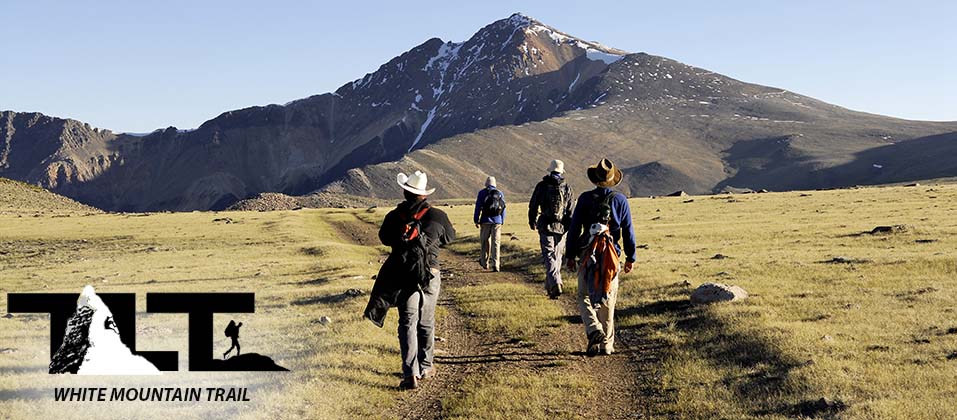
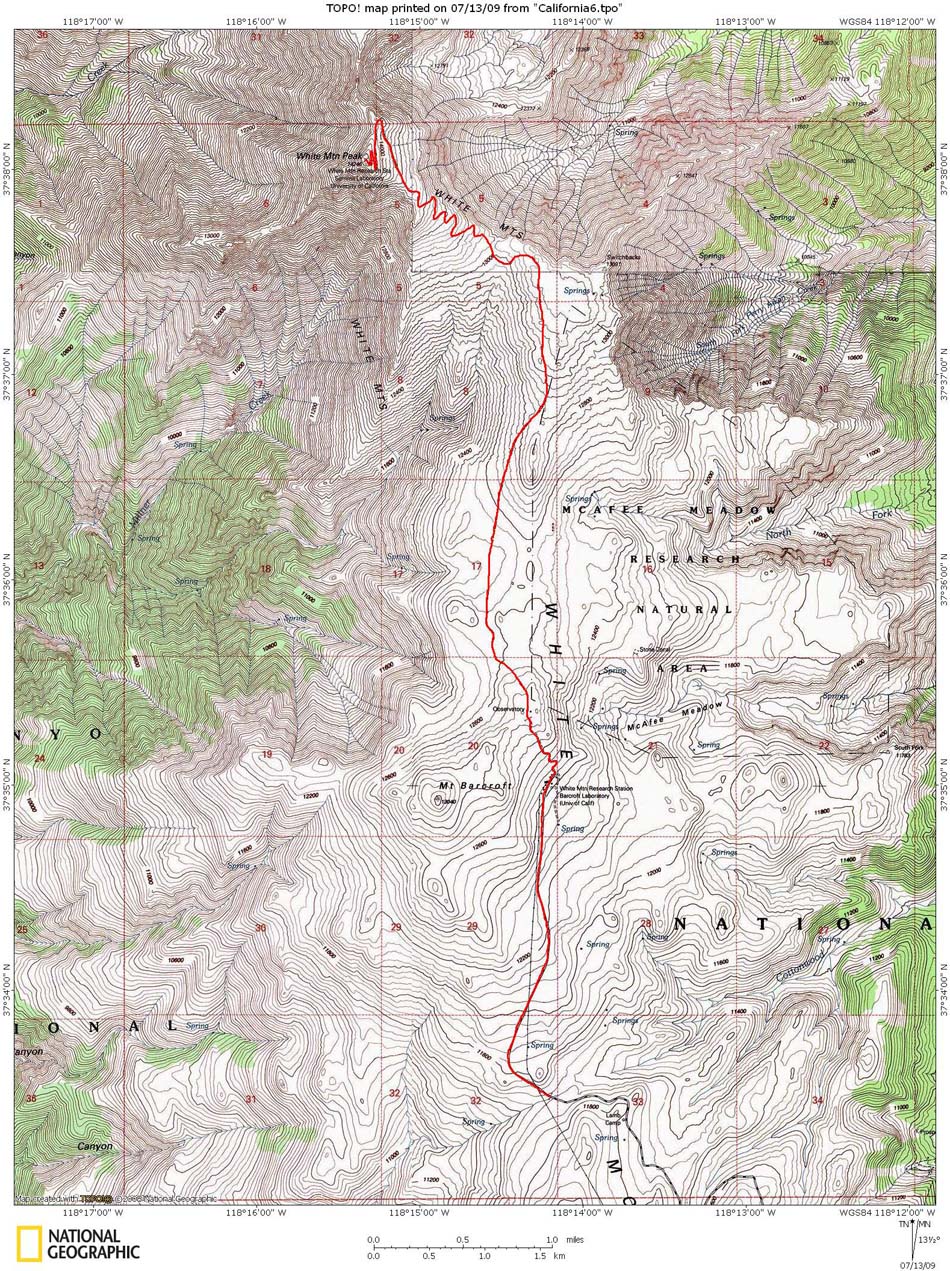
 The Trail to the top of White Mountain Peak - is about as straight forward as it gets. A four wheel drive road goes all the way to the top. But do not take it too lightly, because the round trip involves 14 miles of hiking above 11,670 feet. You will also gain 2,576 feet to reach the 14,246 foot summit. Rarely does anyone camp out along the way (as far as I know), and just about everybody does the trip to the summit and back in one day. This makes altitude the main reason why some people do not make the Summit. Getting use to the altitude is important before setting out for the summit. As mentioned in the getting started section, we usually drive up to about the nine or ten thousand foot level and spend the night in order to get acclimated for our climb.
White Mountain is somewhat centrally located in California, so it is possible to get there from most places in the state in under eight hours. I live in Southern California, and will get off work a little early on Friday, drive up to about the ten thousand foot level, and spend the night to acclimate a bit. Then early next morning on Saturday I finish the drive (which takes about a half hour or so), climb to the top of the peak and back, and finally drive home. This is cool, because you can knock of a California 14er, and only need to take up a Saturday to do it. But if this seems like this is pushing it, you can always make use of Sunday (if you need to rest up before driving home). To learn more about problems associated with high altitude, check out our section on Altitude Sickness.
National Geographic
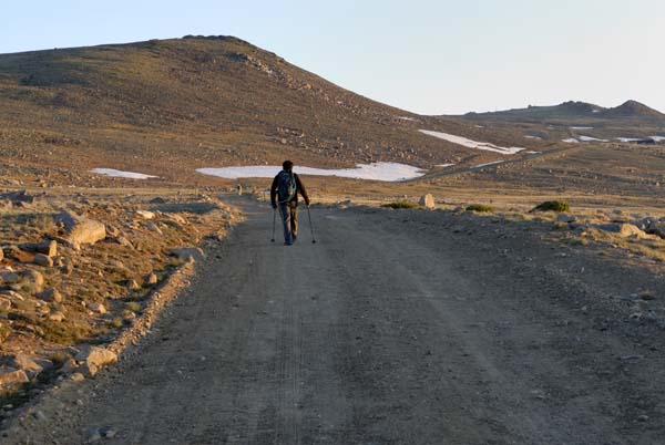 After a short somewhat steep climb up the first slope (after the locked gate), the trail eases up, and gradually winds about for about two miles before reaching the Barcroft Research Station. On an off day, (as you can see in the image to the right), there is plenty of solitude as you hike along the road.
The landscape is very desert like and plant life has been reduced to tough grasses and other low level desert plants.
The peak is actually an extinct volcano rising about 1,600 feet above the plateau surface, and resides inside the Great Basin. White Mountain is only a very small part of it all, and most of the basin is made up by Nevada, half of Utah, and parts of Idaho, Wyoming, Oregon, and California.
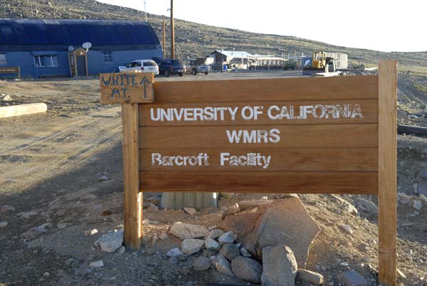 The first major landmark that you will come across is the Barcroft Research Station. The center was formally established on September 1st of 1950. It was set up for the study of two independent fields of scientific interest. The first was to create a high level laboratory on location where biologists could study the effect of high altitude on the ecological environment and the physiological processes that are involved in acclimatization.
Second, it was to fulfill a need for astronomers and astrophysicists to obtain an observatory site that would provide the best seeing conditions with a minimum of atmospheric interference.
The first major landmark that you will come across is the Barcroft Research Station. The center was formally established on September 1st of 1950. It was set up for the study of two independent fields of scientific interest. The first was to create a high level laboratory on location where biologists could study the effect of high altitude on the ecological environment and the physiological processes that are involved in acclimatization.
Second, it was to fulfill a need for astronomers and astrophysicists to obtain an observatory site that would provide the best seeing conditions with a minimum of atmospheric interference.At 12,470 feet, it has become a very useful research center, and much valuable data has been collected and studied. It continues in use today, and is usually staffed by at least eight scientists
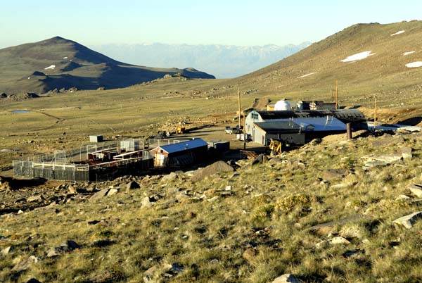
It was constructed in 1951 and is situated at 12,470 ft. Also at this site is the Nello Pace Laboratory, which is located in the main station building. The observatory dome is 1/2 mile away and you can see it in an image below on this page.
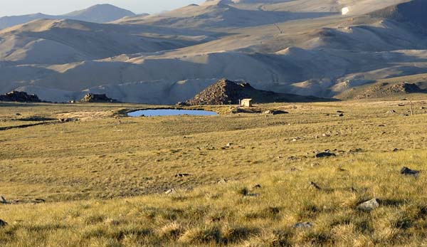
Additionally there is a well and a pond that provides water for the people doing research at this location. Some of the research topics being done both here and at the Summit Facility are as follows: High Altitude Physiology, Altitude Sickness, Climate change Ecology, Population ecology of bighorn sheep, and other topics.
 The White Mountain air is perfect for work in astronomy, and the mountain has the driest air in all the world. This is very important to the astronomer, because any moisture in the atmosphere deflects light and thus diminishes the
seeing ability of any telescope.
The White Mountain air is perfect for work in astronomy, and the mountain has the driest air in all the world. This is very important to the astronomer, because any moisture in the atmosphere deflects light and thus diminishes the
seeing ability of any telescope.White Mountain also has a research structure on the summit at 14,246 feet. At this altitude, 42% of the earth's atmosphere lies below the peak.
The Barcroft well is located next to a small pond (shown in the image to the left), and is fed by a natural springs. This provides needed water. The Barcroft Facility also has a well located inside one of the buildings.
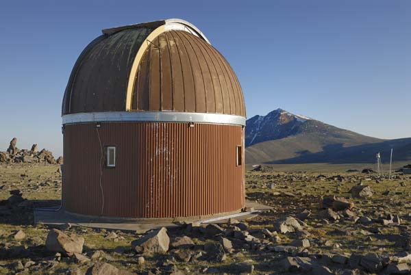 One half mile from the Barcroft Research Center is the Barcroft Observatory (shown to the right). (shown above). It was built in 1976 and a 62" mirror telescope was installed.
The telescope was part of a study to determine the best location for the Keck telescope, which was eventually built in Hawaii.
The telescope was designed to be operated remotely using the Internet and telephone controls. The telescope is mounted on the upstairs level, while the ground floor is occupied by support equipment and the control system.
The observatory is no longer in operation, but makes for an interesting site along the trail. I would have thought it best to continue its operation because of the fantastic astronomical seeing conditions on White Mountain. But the astrophysics group decided no. Only a weather station is currently maintained just outside the dome.
 For current weather conditions at 12,470 feet on White Mountains, click here. The weather is transmitted from on location Barcroft Weather Station.
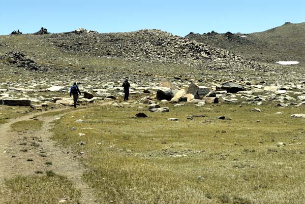
To the left, you see hikers traversing a rocky valley just below the observatory site. These fairly level sections of road are where you can make some good time, and get a few miles behind you.
As you can see, the flora in this high altitude region has been reduced to grass and scattered alpine plants. By late June, most of the snow has melted from the high altitude meadows. In July conditions become warm and very dry. During August and September you may experience an occasional thunderstorm, so make sure you keep clear of the summit and all exposed ridges if lightning is a possibility.
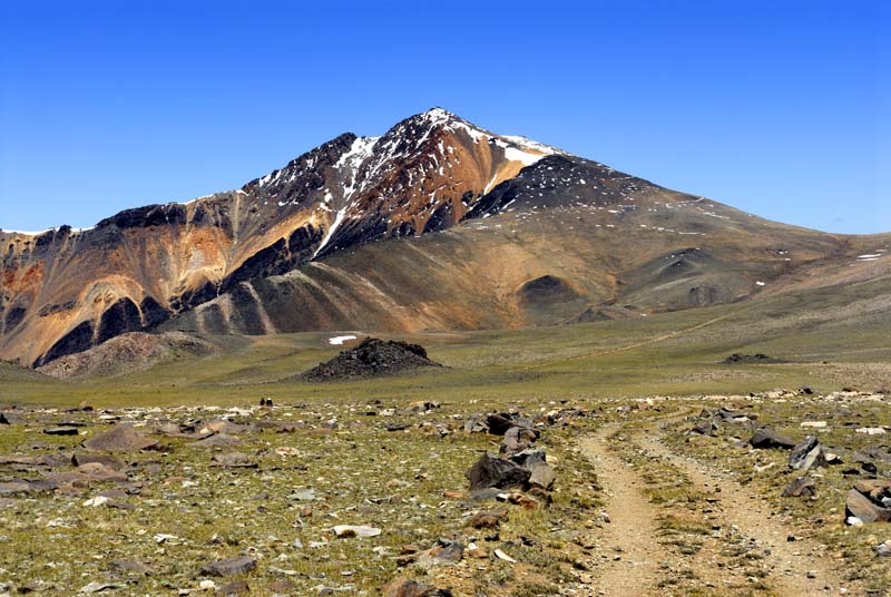 Once you complete about two and three quarter miles of your journey, you will be treated to a grand view of White Mountain Peak.
As mentioned in the White Mountain Home Page, late afternoon is the best time for photos of this unique desert peak.
At this time of day, the long shadows will bring out the beautiful colors and the many minerals which are embedded into the slopes of this fine 14,246 foot peak.
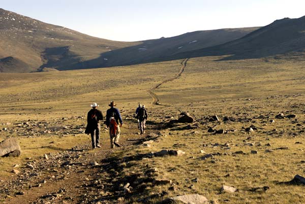 To the left, Above, you see hikers working their way across the McAfee Meadow. The meadow section is about 3 miles in length, and travel will seem to go quite well on the way up. But on the way down it seems to drag a bit since most folks are anxious to get back to their vehicles.
If you are cycling on White Mountain, this three mile section will give you a nice little break. You will also make fantastic time going both up and down on McAfee Meadow.
I love scenes like this, they give me a sense of real back country travel through wide open spaces. The Mcafee Meadow angles slightly downward on the way up, and this is nice when your heading for the summit, but remember, every foot lost on the way up, will have to be made up for later!
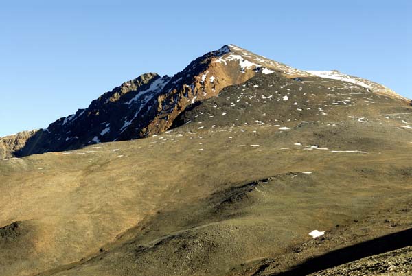
As you can see, the terrain is barren, and you cannot count on a water source along the way. This is why you need to carry enough water along with proper gear to protect youself from the elements.
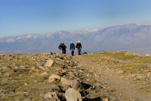 In the photo on the right, above, you will see our group ascended out of the Mcafee meadow. In the background is a nice view of the Sierra Nevada. The great gap between the two ranges is made up of the Owens Valley. One of the deepest valleys in North America. The west face of the White Mountains rises steeply out of Owens Valley. Climbing to any summit from this direction involves a class 1 to class two workout with about 8,000 ft of elevation to gain. Eastern slopes are somewhat gentler and are made up of numerous cirques Most of these cirques are entered or approached by jeep roads and offer scenic yet non-technical routes to the crest.
Four wheel driving adventures abound in and around White Mountain.
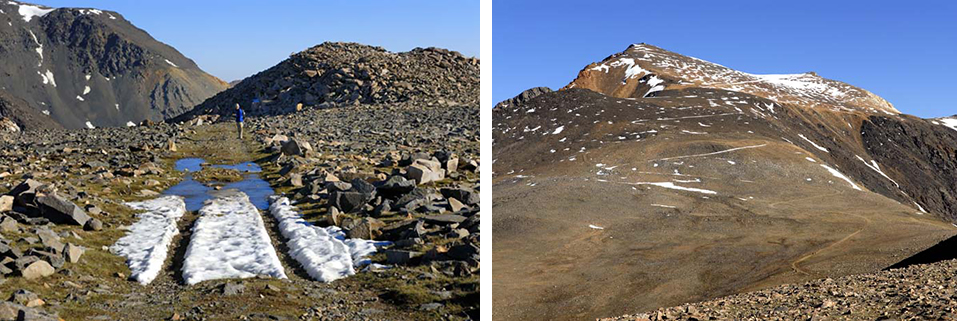
In the image above left, you see my son Sean nearing the end of the Mcafee Meadow area of White Mountain Peak. At the end of this meadow, the road descends somewhat sharply into a small valley, before turning steeply upward. Then you come out to a view as see above right, and if you look very closely you can just make out the Barcroft Summit Research Station on top of White Mountain Peak. Also check out the trail as you look down slope. As mentioned above, you will need to descend steeply into the small valley below, and then turn upward in order to get back on track for the summit.
Here you get a nice view of the switch-backing trail to the top. I have not cycled this part of White Mountain, but from what I have experienced on foot, I believe that this would be the most difficult part by far. You would have to be in pretty amazing shape in order to cycle this portion of the trail to the summit without having to get off and push your bike at some point along the way. The trail gets pretty rough on the climbing portion, and don't forget the altitude factor.
 Above and to the left, you see other hikers making their way up the final switchbacks from the saddle below. This is where you gain the greatest part of the altitude on the trail in the shortest amount of distance. Then, to the right, you see Kevin Jackson making his way up the final slopes of White Mountain Peak. The air is at its thinnest here, and each step takes effort.
 Both the above images were taken from just below the summit. There can still be a fair amount of snow even in July (when the above photo was taken) in some places along the final portion of the trail. In the upper portion of the right hand image, you can just make out a hazy view of the US state of Nevada.
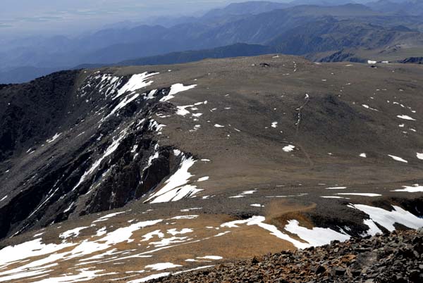 White Mountain Peak has some amazing views from its lofty 14,246 foot summit. So make sure to reserve some time to take it all in. But in the meantime, make use of the Summit Link, and check out some of our photos from the top of White Mountain Peak.
Well, that's about it for the White Mountain Peak Trail. Hope you enjoyed the journey along the trail/road to the top. As mentioned above, the trail is very straight forward, and for the most part, a four wheel drive vehicle with a bit of ground clearance could just about get to the top. For more adventure on this wonderful desert mountain peak, just click on the menu above and select the White Mountain option.
Email Sign Up
| Join the Adventure! Sign up here for Timberline Trails Monthly Newsletter |

Join us on Instagram

©2006-2026 TimberlineTrails. All Rights Reserved.
....