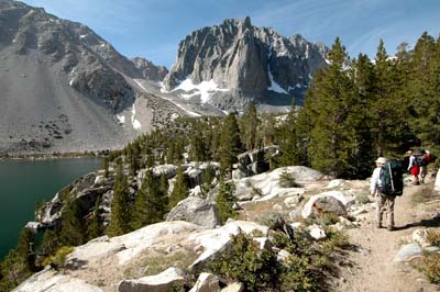
Getting Started on North Palisade - involves gaining access to the region by one of three different approaches. First, their is the Bishop Pass Trail. It will give you access to the south western side of the divide and begins (as the name implies) from the little town of Bishop, California. This in my book is the more dificult and lengthy approach, and depending on season, can involve a whole lot of bolder hopping, which is certainly not my idea of fun. Second, (fifteen miles to the South of Bishop) is the even smaller town of Big Pine. From there we have a choice of two forks in the divide. The South Fork of Big Pine Creek, and the North Fork of Big Pine Creek.
The Southern Fork (option two) can be used, but as with the Bishop Pass mentioned above, this is the more lengthy approach. But it is the best option if you are climbing peaks such as Middle Palisade, Norman Clyde Peak, or other peaks in the Southern Palisade region.
 Then third (in the lineup on this page), is the Big Pine Creek North Fork. I like this approach by far better than the others, because it gives you the most direct access to the Palisade Glacier (and the U-Notch couloir) which in turn will provide a very direct climbing line to the summit of North Palisade.
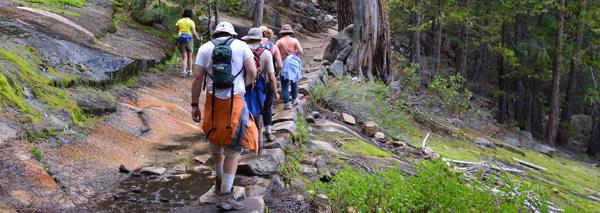
Having been on both sides of the Palisade Crest, I would say that the North Fork approach is the classic alpine approach and involves exciting multi terrain climbing. You have a trail, a bit of cross country travel, a crossing of the largest glacier in the Sierra Nevada (The Palisade Glacier), a steep snow and ice couloir to negotiate (the U-Notch Couloir), and finally, a bit of technical rock climbing. All things considered, it is one of the most classic climbs in the Sierra.
To get there, travel on US highway 395 to the little town of Big Pine located at the base of the Eastern Sierra's and once in town, turn west on the Glacier Lodge Road (West Crocker Road) that continues uphill for 13.9 miles and ends at the trailhead parking lot. The road does continue another half mile to the site of the old Glacier Lodge (burned down), but there is no overnight parking in that area.
Click on "View larger map" below and then you can put in your location and it will give you directions to the Trailhead for the Big Pine Creek North Fork.
Once on the permit page, select "Explore available permits" The put in the Permit Type, Date of Entry, and your Group Size. Then in the list of Trailheads, choose the "Big Pine Creek North Fork" (as mentioned above, I perfer this choice). Then click on the entry date you want and if available, click the "Book Now" button at the bottom of the page. You can also get free maps and other info by clicking on the Trailhead of your choice on this page. The Big Pine Creek North Fork is also a great choice for climbing Mt Sill, Polemonium Peak, and others that border the Palisade Glacier. Email Sign Up

|
Join the Adventure! Sign up here for Timberline Trails Monthly Newsletter |

Join us on Instagram

©2006-2024 TimberlineTrails. All Rights Reserved.
....