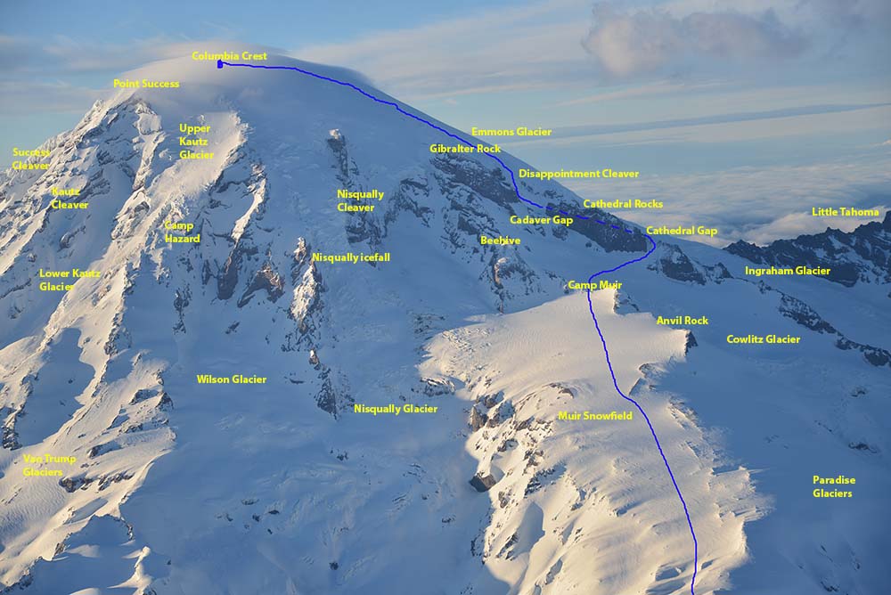
 Rainier Aerial Photography: I took the below two images of Mt Rainier from my climbing partner Mike's lightweight aircraft to give you a good idea of the terrain of the peak. In the photo below, you can see the side of the mountain that most climbers use to gain the summit of this magnificent mountain. Coming from the Paradise Lodge parking area, most folks climb up via the Muir Snowfield and use Camp Muir (as seen below) for a place to layover and then finish the climb the next day. The blue line shows the route we took to summit Mt Rainier.
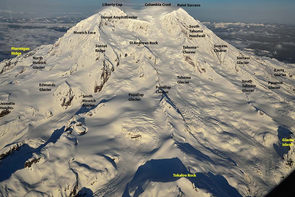
 The aerial photo below shows the side of Mt Rainier looking Southwest. This side is heavily glaciated and far fewer summit attemps are done from this side of the peak which is more remote along with more difficult climbing conditions.

Email Sign Up

|
Join the Adventure! Sign up here for Timberline Trails Monthly Newsletter |

Join us on Instagram

©2006-2024 TimberlineTrails. All Rights Reserved.
....