
Weather on Mt Whitney varies greatly during the year and can certainly be unpredictable at times. Temperatures at the lower elevations are generally warm. At higher elevations in the night, even in the summer months temperatures can fall below freezing. Typical winter temperatures above 9,500 feet range from -14 degrees F to 12 degrees at night and from 15 - 50 degrees F during the day.
Ninety five percent of total precipitation (which includes both rain and snow) falls between the months of October and May, with more than half falling in January, February, and March. The frequency of summer showers increase at higher elevations and correspondingly there are more cloudy days. But even though these thundershowers are of short duration they are still a danger to the hiker/climber on the summit or high ridges on Mt Whitney and other Sierra Peaks. That being said, if you detect a thunderstorm developing, vacate the summit and high ridges at once. The
first recorded fatality on Mt Whitney was due to lightning.
Snow is one of the most spectacular features in the Sierra Nevada (the second snowiest mountain range on the continent) but due to the fact that Mt Whitney resides in the southern portion of the Sierra Nevada, it does not get nearly the amount of snow pack that the Palisade or Mammoth Lakes region do.
Latest Trail Conditions as of July 6th
Plenty of water flowing with snow patches here and there. The trail is in good condition and most people are going to the Summit just using trecking poles only. A bit slippery in the Cables Section, but with careful foot placement, it should not be a problem. Permits are in force, so make sure you have one so you don't get turned around.
MT WHITNEY AERIAL VIEW - We are proud to have the following link added to our Mt Whitney lineup. It is a mixed slide-show showing many key features of Mt Whitney and the surrounding areas from both the ground and the air. So click on the following link, turn up the music, use the biggest monitor you got in full screen video mode, and enjoy high resolution photos of Mt Whitney.
Mt Whitney Aerial Slide-show also check out our Mt Whitney Aerial Flight Video (a moving view completely around Mt Whitney and its surrounding neighbors).
TRAIL GUIDE - for an in-depth write up on hiking from the Trailhead at Whitney Portal to the Summit, please check out our page on the Mt Whitney Trail.
THE FOLLOWING IS THE WEATHER FORECAST FOR THE WHITNEY PORTAL AREA AT 8,300 FT
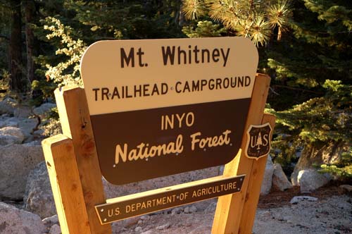
The Whitney Portal Hosts the Trail-head for Hikers, Backpackers and Climbers on Mt Whitney
| Saturday 8/1 Sunny, with a high near 87. Light and variable wind becoming east 8 to 13 mph in the morning. Winds could gust as high as 18 mph. |
| Saturday Night 8/1 Mostly clear, with a low around 64. North northeast wind 5 to 10 mph becoming west in the evening. |
| Sunday 8/2 Sunny, with a high near 87. Light and variable wind becoming east southeast 8 to 13 mph in the morning. Winds could gust as high as 20 mph. |
| Sunday Night 8/2 Clear, with a low around 64. South southwest wind 5 to 9 mph becoming west in the evening. |
| Monday 8/3 Sunny, with a high near 86. Northwest wind 5 to 13 mph becoming southeast in the afternoon. Winds could gust as high as 20 mph. |
| Monday Night 8/3 Clear, with a low around 63. |
| Tuesday 8/4 Sunny, with a high near 86. |
| Tuesday Night 8/4 Clear, with a low around 63. |
| Wednesday 8/5 Sunny, with a high near 86. |
| Wednesday Night 8/5 Clear, with a low around 64. |
| Thursday 8/6 Sunny, with a high near 85. |
| Thursday Night 8/6 Mostly clear, with a low around 64. |
| Friday 8/7 Sunny, with a high near 84. |
 The Photo Above Shows Trail Camp on Mt Whitney at an elevation of 12,000 ft.
Most backpackers/climbers on Mt Whitney use this as a base camp for Summit day.
Plenty of great sites already established so it makes for easy setup.2,496 feet of elevation left to gain before
THE FOLLOWING IS THE WEATHER FORECAST FOR WHITNEY Trail Camp AT 12,000 FT
The Photo Above Shows Trail Camp on Mt Whitney at an elevation of 12,000 ft.
Most backpackers/climbers on Mt Whitney use this as a base camp for Summit day.
Plenty of great sites already established so it makes for easy setup.2,496 feet of elevation left to gain before
THE FOLLOWING IS THE WEATHER FORECAST FOR WHITNEY Trail Camp AT 12,000 FTAs mentioned above, most backpackers/climbers set up camp here before going for the summit.
| Saturday 8/1 Sunny, with a high near 66. South southwest wind 7 to 10 mph, with gusts as high as 18 mph. |
| Saturday Night 8/1 Clear, with a low around 46. Northwest wind 6 to 10 mph. |
| Sunday 8/2 Sunny, with a high near 65. West southwest wind 6 to 14 mph becoming east northeast in the afternoon. Winds could gust as high as 22 mph. |
| Sunday Night 8/2 Clear, with a low around 46. West northwest wind 6 to 11 mph. |
| Monday 8/3 Sunny, with a high near 64. Northwest wind 6 to 10 mph becoming southeast in the afternoon. |
| Monday Night 8/3 Clear, with a low around 45. |
| Tuesday 8/4 Sunny, with a high near 64. |
| Tuesday Night 8/4 Clear, with a low around 45. |
| Wednesday 8/5 Sunny, with a high near 64. |
| Wednesday Night 8/5 Mostly clear, with a low around 46. |
| Thursday 8/6 Sunny, with a high near 63. |
| Thursday Night 8/6 Mostly clear, with a low around 45. |
| Friday 8/7 Sunny, with a high near 63. |

THE FOLLOWING IS THE WEATHER FORECAST FOR WHITNEY'S SUMMIT AT 14,508 FT
| oday 8/1 Sunny, with a high near 56. South southwest wind 8 to 10 mph becoming east in the afternoon. |
| Saturday Night 8/1 Clear, with a low around 42. North wind 6 to 10 mph becoming south southeast after midnight. |
| Sunday 8/2 Sunny, with a high near 56. West southwest wind 6 to 14 mph becoming east northeast in the afternoon. Winds could gust as high as 22 mph. |
| Sunday Night 8/2 Clear, with a low around 41. North wind 7 to 11 mph becoming west in the evening. |
| Monday 8/3 Sunny, with a high near 55. Northwest wind 6 to 9 mph becoming southeast in the afternoon. |
| Monday Night 8/3 Clear, with a low around 41. |
| Tuesday 8/4 Sunny, with a high near 55. |
| Tuesday Night 8/4 Mostly clear, with a low around 41. |
| Wednesday 8/5 Sunny, with a high near 55. |
| Wednesday Night 8/5 Mostly clear, with a low around 41. |
| Thursday 8/6 Sunny, with a high near 54. |
| Thursday Night 8/6 Mostly clear, with a low around 41. |
| Friday 8/7 Sunny, with a high near 53. |
Email Sign Up

|
Join the Adventure! Sign up here for Timberline Trails Monthly Newsletter |

Join us on Instagram

Matt 7:24-27 "Therefore everyone who hears these words of mine and puts them into practice is like a wise man who built his house on the rock. The rain came down, the streams rose, and the winds blew and beat against that house; yet it did not fall, because it had its foundation on the rock. But everyone who hears these words of mine and does not put them into practice is like a foolish man who built his house on sand. The rain came down, the streams rose, and the winds blew and beat against that house, and it fell with a great crash."
©2006-2026 TimberlineTrails. All Rights Reserved.
....